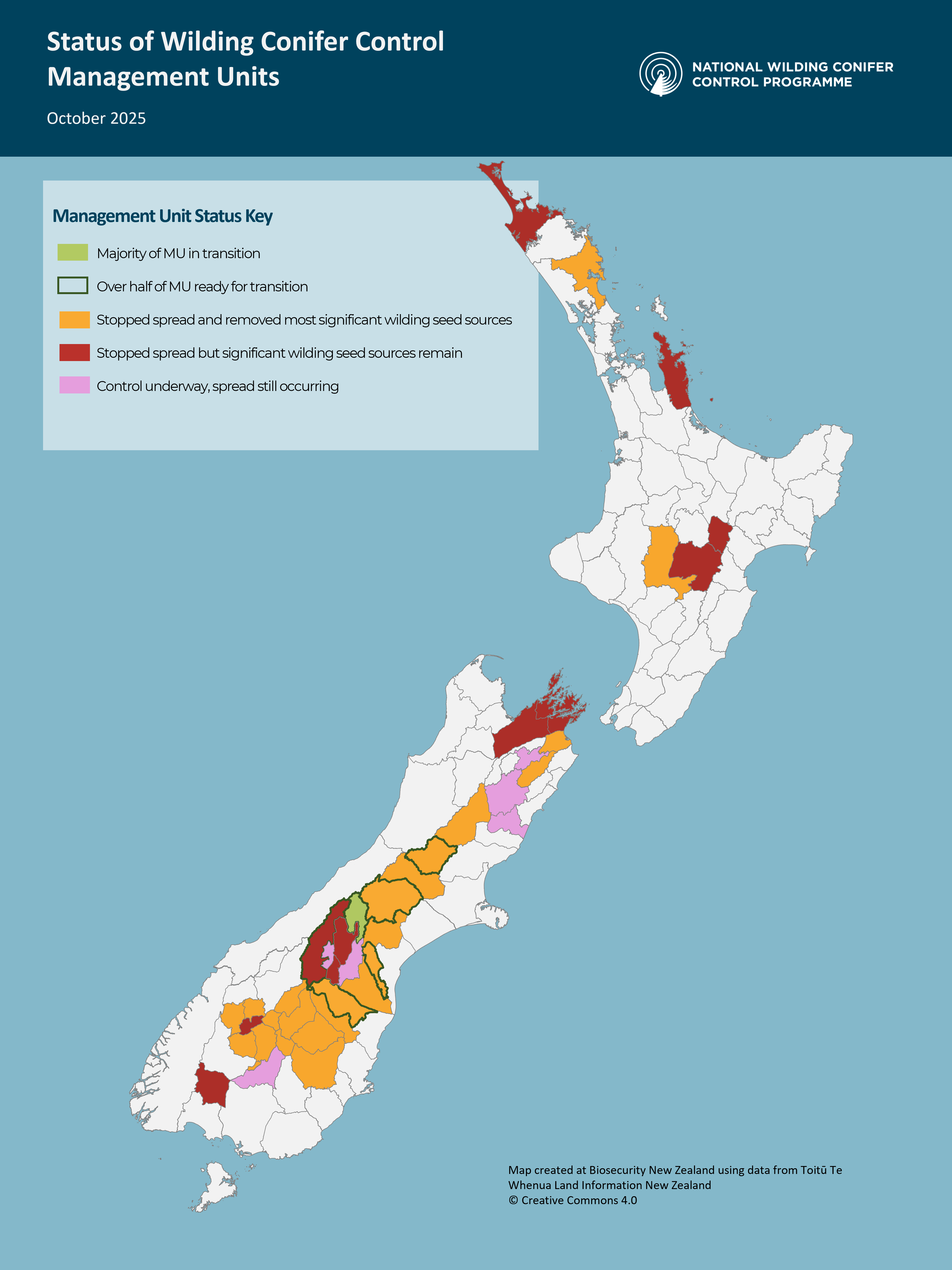
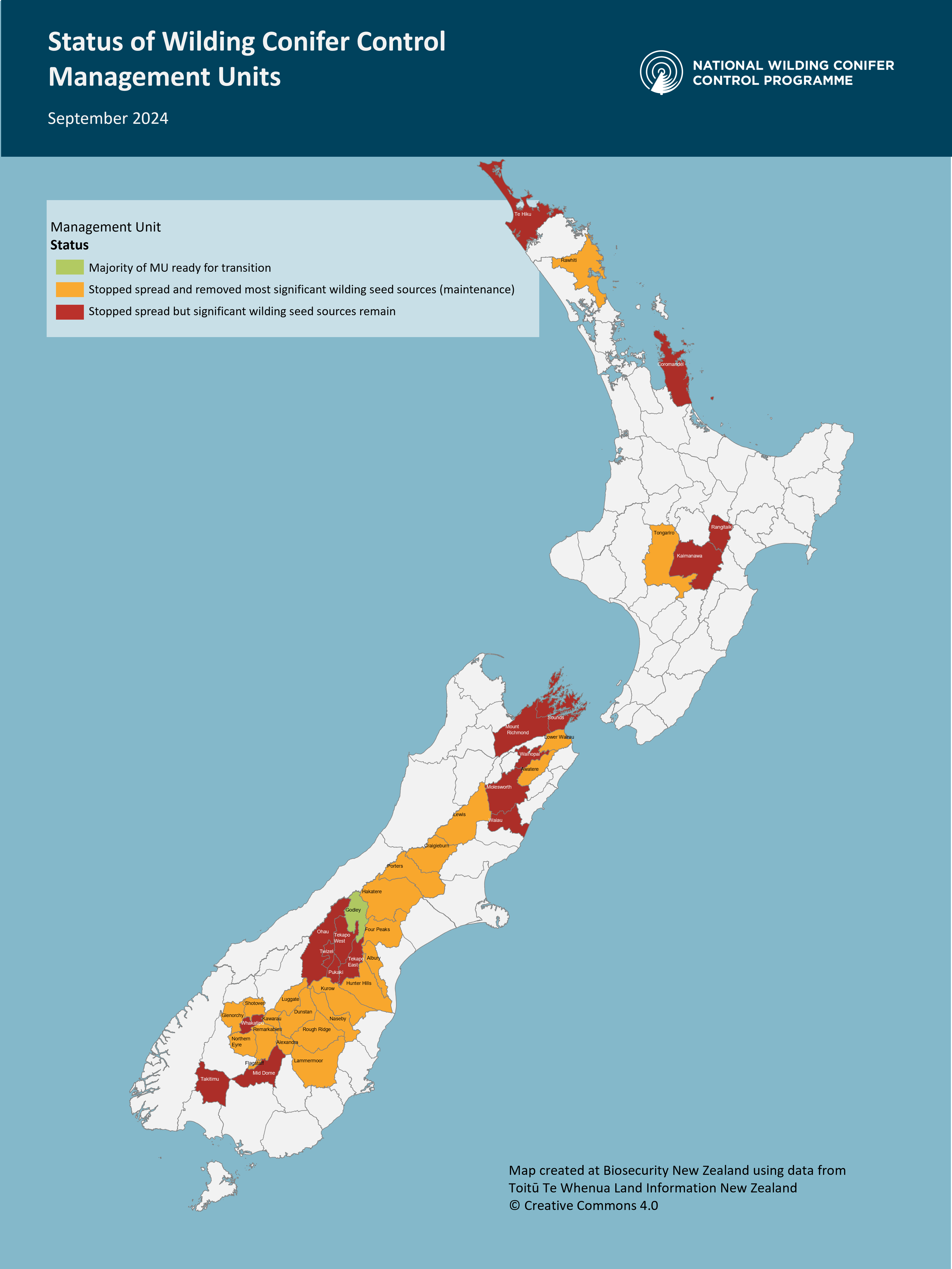
Current control status
These maps indicate the current state of all Management Units (MUs) where control operations have been carried out through the National Programme since 2016. They are a high level view, and a snapshot in time during the life of each MU.
The progress made reflects control efforts made by local communities and landowners as well.
To see in which MUs the Programme is delivering operations currently, see the Active MUs maps back on the Controlling Wilding Pines page.
Progress at end of 2024/25 year
|